A study aimed at developing a holistic understanding of weathering across forelands of retreating ice sheets
 |
A diagram of the hypothesis behind GrAINfluxes. |
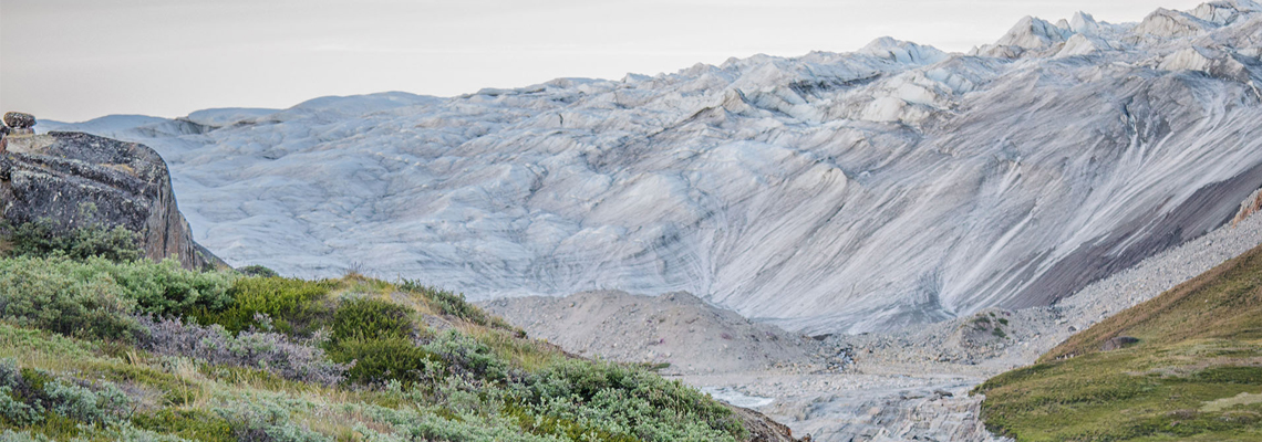
A brief description of our projectFollowing the last glacial maximum about 20,000 yrs ago, ice sheets retreated from much of North America and Eurasia, leaving the Greenland Ice Sheet (GrIS) as the largest ice sheet in the northern hemisphere. Chemical weathering of finely ground sediments exposed during retreat of the ice sheets alters atmospheric CO2 concentrations as well as nutrient and isotopic fluxes to the ocean. The nutrient fluxes are likely to stimulate ocean productivity, further impacting atmospheric CO2, while the isotopic fluxes may produce a history of ice sheet dynamics that is preserved in marine sediments. Most previous studies of weathering in the vicinity of the GrIS have focused on proglacial watersheds that receive dilute but high volumes of glacial meltwater from the top and underneath the ice sheet. In contrast, deglacial watersheds that are no longer physically connected to the ice sheet and instead are sourced only by annual precipitation and permafrost melt have received little attention. Yet, preliminary work from our group and others suggests deglacial watersheds may be equally or more important than proglacial watersheds for oceanic and atmospheric fluxes. The Greenland Research Project at UF addresses the question of how mineral weathering reactions impact atmospheric CO2 and oceanic nutrient and isotope fluxes across proglacial and deglacial watersheds of western Greenland. Results of the project have the potential to change our understanding of global CO2, nutrient, and isotope cycling in response to ice sheet collapse. This understanding should inform predictions of future responses to global warming and ice sheet retreat and provide a context to interpret past high latitude ice sheet retreat and climate change based on marine isotope records. |
|
 |
A google earth image of our new site in Narsarsuaq, where we will be sampling both deglaciated and proglacial watersheds. |